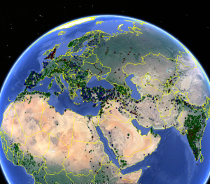
The last task I performed for AQUASTAT was to try to find the best way to estimate the anthropogenic evaporation from dams. The paper can be found here, but here I provide one of the fun outputs, a map of 75000 dams!
ok, ok, ok… it’s not REALLY 75000 dams, this is an duplicate-containing amalgam of:
- AQUASTAT dams with known location (green up arrow)
- AQUASTAT dams with guessed location, estimated by City if known, else by State if known, else by Country (green diagonal arrow)
- OpenStreetMap (OSM) dams using the awesome OverPass Turbo API (blue left arrow)
- Wikipedia dams… somehow inferred from dbpedia (red/down arrow)
There really is a lot of redundancy, but I’m still pretty sure that this is the biggest collection of dam locations to date. Still, for those interested in the full kml, it’s available for download »here« (CAREFUL… 200 MB), or just the minimum information in a small csv file »here«. BTW, there’s a tutorial on how to create a google earth file like this one from an excel file on this blog.
